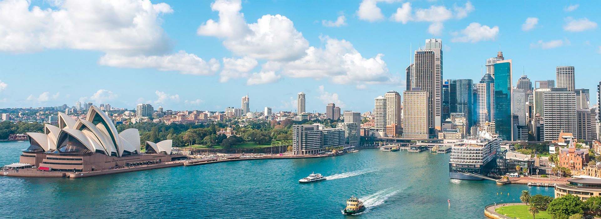
Sydney has been driving a property market turnaround in the latter half of 2019, and the experts have given their picks on which suburbs will see the biggest growth in 2020.
Coogee
Coogee is a gentrified coastal suburb South-East of Sydney CBD which will see the benefits of infrastructure projects over 2020. The South-East Light Rail project, is a $2.2B project and will see a 12km light rail network connect Circular Quay to Kingsford. In addition to the light rail a $5M upgrade of the Coogee Bay Road town centre commenced in September 2018.
- Distance from CBD: 8km South East
- Total population: 14,012
- Median Household Income: $2099 (weekly)
- Walk Score: 79 – Very Walkable
Kingsford
Kingsford is a residential suburb, South East of Sydney CBD and situated directly south of the University of New South Wales. It has cultural amenities along Anzac Parade and Gardners Road and is less than 5 km from Coogee Beach. Kingsford will also benefit from the South-East light rail project with a direct connection to the CBD.
- Distance from CBD: 7km South East
- Total population: 14,100
- Median Household Income: $1227(weekly)
- Walk Score: 82 – Very Walkable
Kensington
Kensington is located South-East of Sydney CBD in the local government area of the City Of Randwick. Kensington lies to the immediate south of Moore Park and west of Randwick Racecourse. The principal landmarks of the suburb are the main campus of the University of New South Wales, National Institute of Dramatic Arts (NIDA) and the exclusive Australia Golf Club. Kensington will also benefit from the South-east light rail project.
- Distance from CBD: 6km South East
- Total population: 12,776
- Median Household Income: $1498(weekly)
- Walk Score: 81 – Very Walkable
Maroubra
Maroubra is a beachside suburb in the Eastern Suburbs of Sydney and located South-East of Sydney CBD. Maroubra is the largest suburb in the area governed by Randwick City Council in both area and population.
- Distance from CBD: 10km South East
- Total population: 29,594
- Median Household Income: $1428(weekly)
- Walk Score: 74 – Very Walkable
Neutral Bay
Neutral Bay is a harbourside suburb on the Lower North Shore of Sydney. It is north of Sydney CBD in the local government area of North Sydney Council. Surrounding suburbs include Cammeray, Milsons Point and Cremorne.
- Distance from CBD: 1.5km North
- Total population: 9384
- Median Household Income: $2073(weekly)
- Walk Score: 85 – Very Walkable
Cammeray
Cammeray is a suburb on the lower North Shore of Sydney and located North of Sydney CBD. The majority of residences are in the form of stand-alone or semi-detached, single or double-storey houses. Many of the quieter streets are lined with trees and have nature stips. This gives Cammeray a pleasant green look.
- Distance from CBD: 5km North
- Total population: 6783
- Median Household Income: $2239(weekly)
- Walk Score: 85 – Very Walkable
Balmain
Balmain is an affluent neighbourhood west of Sydney CBD with a trendy restaurant scene. Relaxed pubs and cafes occupy Victorian buildings on Darling Street, alongside boutique stores, artisan bakeries and happening eateries. Well-heeled families, artists and media figures reside in the restored sandstone workers’ cottages lining the leafy streets and stalls at Saturday’s Balmain Markets sell organic food, crafts and fashion.
- Distance from CBD: 5km West
- Total population: 9783
- Median Household Income: $2456(weekly)
- Walk Score: 93 – Walkers Paradise
Dulwich Hill
Rozelle is a gentrified residential suburb in the inner-west of Sydney CBD. Strong in cultural amenities with cafes and restaurants along Darling Street, it is a destination suburb due to its boutique stores and eateries.
- Distance from CBD: 4km West
- Total population: 7919
- Median Household Income: $2598(weekly)
- Walk Score: 84 – Very Walkable
Summer Hill
Dulwich Hill is a suburb in the Inner West of Sydney it is located south-west of the Sydney CBD. Dulwich Hill stretches south to the shore of the Cooks River and is an established residential area with many examples of federation Architecture. The streets are wider than many inner-city suburbs and houses are bigger than some older, neighbouring suburbs such as Petersham.
- Distance from CBD: 7.5km South-West
- Total population: 12,981
- Median Household Income: $1540(weekly)
- Walk Score: 84 – Very Walkable
Marrickville
Marrickville is a gentrified suburb in the Inner West of Sydney and located south-west of the Sydney CBD. It is the largest suburb in the inner-west and sits on the northern bank of the Cooks River. It is a diverse suburb consisting of both low and medium density residential, commercial and light industrial areas. Many Marrickville homes are detached or terraced Victorian houses built in the late 19th century while many others were built in the Federation style in the early 20th century.
- Distance from CBD: 7km South-West
- Total population: 24,612
- Median Household Income: $2324(weekly)
- Walk Score: 80 – Very Walkable
Ashfield
Ashfield is a suburb in the Inner West of Sydney and located south-west of Sydney CBD is relatively high for Australia, with the majority of the area’s dwellings being a mixture of mainly post-war low-rise apartments and federation-era detached houses. Amongst these are a number of grand Victorian buildings that offer a hint of Ashfield’s rich cultural heritage.
- Distance from CBD: 8km South-West
- Total population: 22,190
- Median Household Income: $1314(weekly)
- Walk Score: 75 – Very Walkable
Newtown
Newtown is a diverse, bohemian neighbourhood that bustles with activity day and night. Shoppers head to King Street’s indie bookshops and thrift stores. Hip bars and eateries with multicultural fare cater to locals and University of Sydney students and The Enmore Theatre hosts comedy revues and live music. Restored Victorian buildings and street art, including a mural of Martin Luther King, round out the scene.
- Distance from CBD: 4km South-West
- Total population: 14,148
- Median Household Income: $1753(weekly)
- Walk Score: 95 – Walkers Paradise
Kogarah
Kogarah is a residential suburb of southern Sydney located south of the Sydney CBD and is considered to be the centre of the St George area. Kogarah’s main shopping area is located around Kogarah railway station on Railway Parade, Regent Street and on the opposite side of the railway line on Station Street.
- Distance from CBD: 14km South
- Total population: 12,763
- Median Household Income: $1238(weekly)
- Walk Score: 84 – Very Walkable
Bexley
Bexley is a suburb in southern Sydney located south of the Sydney CBD in the local government area of the Bayside Council and is part of the St George area. Bexley contains a mixture of residential, commercial and light industrial developments and its main shopping strip (usually known as the ‘Bexley Shopping Centre’) is located on Forest Road.
- Distance from CBD: 14km South
- Total population: 19,067
- Median Household Income: $1358(weekly)
- Walk Score: 71 – Very Walkable
Source: properyupdate.com.au